One Foot in a Different Century: The Accidental Lines That Still Decide American Life
Photo: historic surveying equipment compass and chain in American wilderness, via c8.alamy.com
There is a spot along the Maryland-Pennsylvania border where you can stand with your feet about eighteen inches apart and be in two different states simultaneously. This is not remarkable in itself — you can do that at dozens of points along any state line. What's remarkable is what those eighteen inches separate: different income tax rates, different property tax structures, different school funding formulas, different voting districts, different rules about what you can build and how you can build it.
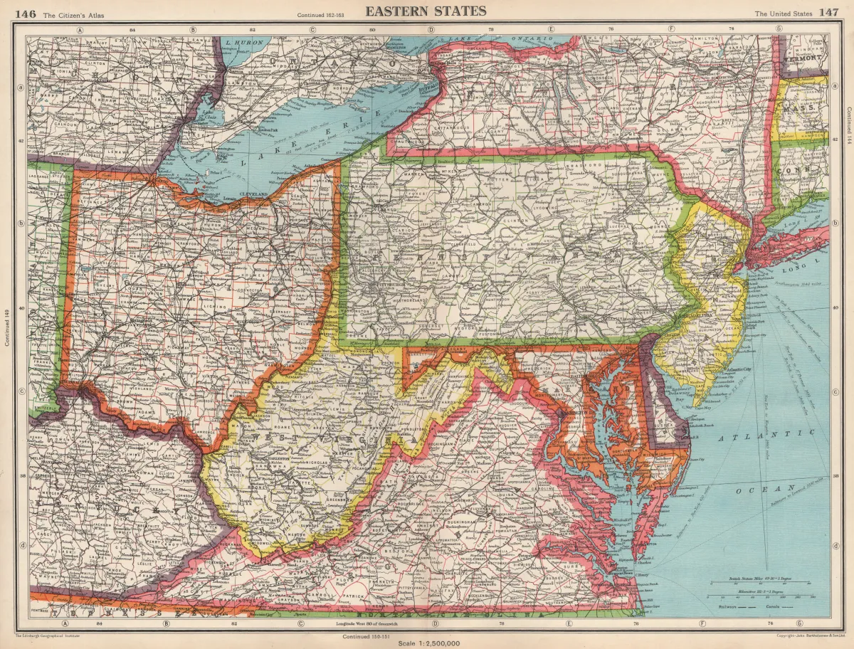 Photo: Maryland-Pennsylvania border, via images.antiquemapsandprints.com
The line was drawn in the 1760s by Charles Mason and Jeremiah Dixon, two English surveyors hired to resolve a boundary dispute that had been generating lawsuits and occasional violence for decades. They did their best work with the instruments available to them, but the instruments available in 1763 were not precise by modern standards. Some sections of the Mason-Dixon Line are off by measurable amounts. Those errors have been governing human lives ever since.
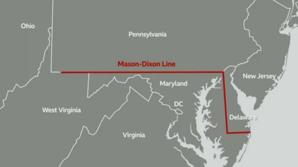 Photo: Mason-Dixon Line, via ichef.bbci.co.uk
The Surveyor's Bad Day Is Your Property Tax
It's tempting to think of political borders as the product of deliberate negotiation — rooms full of serious men with maps, arguing about principles and reaching reasoned conclusions. Sometimes that happened. More often, the line got drawn by whoever was standing in a field with a compass when the arguing finally stopped.
The history of American surveying is, in large part, a history of improvisation under difficult conditions. Surveyors worked in terrain that was frequently hostile: swamps, mountains, dense forest, river bottoms that flooded unpredictably. They worked with instruments that were sensitive to temperature changes, magnetic anomalies, and the simple accumulated error of measuring long distances in short increments. They worked under political pressure from parties who had strong opinions about where the line should fall and weren't always honest about their reasons.
And they worked tired. This matters more than it sounds. A surveyor who has been in the field for six weeks, sleeping in rough camps, eating whatever was available, dealing with equipment problems and political interference, is not making his best decisions at the end of a long day. But the decisions he makes at the end of that long day get recorded, filed, and treated as permanent.
Human psychology hasn't changed in five thousand years, and one of the most consistent findings across all of recorded history is that tired people make worse decisions and are less likely to question their own judgment. The surveyor who puts the stake in the ground after a fourteen-hour day doesn't go back and check his work. He goes to sleep.
The Ellicott Line and the Borderlands That Shouldn't Exist
In 1796 and 1797, Andrew Ellicott surveyed the boundary between the United States and Spanish Florida along the 31st parallel. The 31st parallel sounds precise — it's a line of latitude, after all, a mathematical concept rather than a political one. In practice, determining exactly where the 31st parallel ran on the ground, with the instruments of the late eighteenth century, required judgment calls at every step.
Ellicott made those calls. He was a skilled surveyor and a careful man, but he was also working in the deep South in summer, which meant heat, insects, disease, and a workforce that was frequently incapacitated. The line he drew was accepted by both governments, became the basis for subsequent territorial arrangements, and eventually fed into the borders of Mississippi and Alabama.
Mississippi and Alabama are not the same state. They have different political cultures, different economic profiles, different histories. But the line between them runs north from the Gulf coast to the Tennessee border, and significant portions of that line were drawn by men making judgment calls about where county boundaries fell and which watershed belonged to which drainage system. Those calls compounded over generations into the distinct political geographies we treat as natural and inevitable today.
Nothing about them is natural. Everything about them is accumulated accident.
You Can Visit the Mistakes
This is where the travel angle becomes genuinely interesting, because the places where you can feel these accidents most vividly are physical, visitable, and often surprisingly unmarked.
Drive along the Kentucky-Tennessee border in the western part of both states and you'll pass through communities that were split by the survey line — families whose farms ended up in different states, churches that technically straddle a state boundary, cemeteries where the property records get complicated. The line was supposed to follow the 36°30' parallel, but the surveyors of 1779 and 1780 had a difficult time maintaining accuracy across the terrain, and the resulting boundary wanders noticeably from where it was supposed to be.
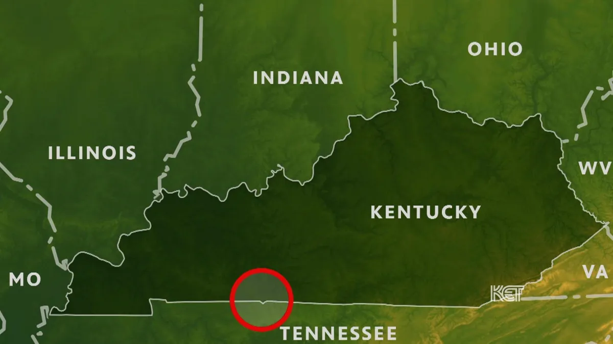 Photo: Kentucky-Tennessee border, via image.pbs.org
The consequences are not abstract. Property in one county is taxed differently than property in the adjacent county across the line. Schools on one side receive different per-pupil funding than schools on the other. The congressional district you're in determines who represents you in Washington. All of this flows from a line that was drawn by exhausted men with 18th-century instruments who were trying to split the difference between competing colonial land grants.
Or consider the Northwest Territory surveys of the early 1800s, which established the township-and-range system that still governs land records across the Midwest. The system is elegant in theory — a grid of six-mile squares covering the entire territory. In practice, the surveyors discovered that the earth is round, which means parallel lines of longitude converge as you move north, which means the perfect grid doesn't stay perfect over long distances. The solution was correction lines — periodic adjustments that create the jogs you can still see in Midwestern roads, the places where a straight county road suddenly shifts half a mile east or west before continuing. Those jogs are in the land records. They affect lot sizes, fence lines, and property values to this day.
The Unintended Architecture of American Life
There's a category of things we might call unintended architecture — structures that weren't designed but that function as powerfully as anything that was. American state and county lines are among the most consequential examples. They were drawn by specific people under specific conditions, often with incomplete information and under time pressure, and they have organized American life ever since in ways that their drawers never imagined and couldn't have predicted.
The school funding disparities that track so closely along county lines in states like Texas or New York — disparities that determine educational outcomes for millions of children — are in part the downstream consequence of where a surveyor put his stake on a particular afternoon in a particular year. The political gerrymandering that shapes congressional districts starts from a baseline of county and state lines that were themselves drawn without democratic input by men appointed by colonial governors or territorial administrators.
This is not a counsel of despair. It's an argument for paying attention to origins. The most powerful structures in American life are often the ones that feel most natural, most inevitable, most simply there — and they feel that way precisely because their contingent, accidental origins have been smoothed over by time and repetition.
The next time you cross a state line on an American highway — the little sign, the change in road quality, the subtle shift in what's on the radio — take a second. You're crossing a decision that somebody made, probably under less than ideal conditions, probably without fully thinking through the consequences. That decision is still running your life in ways you haven't noticed yet.